11/25/2006

GRANTS
WECHE MOKADHO
;
ALARM AS WANTON ENVIRONMENTAL NEGLECT WREAKS HAVOC IN GWASSI HILLS
By Leo Odera Omolo
Wanton destruction of indigenous tree and natural forest in Gwassi hills has impacted negatively in a number of ways.
Latest climate and weather changes have resulted to unreliable rainfall, drying up of streams and springs, increased soil erosion, poor crop yields, loss of biodiversity, especially the medicinal plants, indigenous vegetables, fruits, grass for thatching houses by the locals, trees for making granaries, loss of aesthetic nature of the environment and pollution of Lake Victoria.
Major impact of environmental degradation recently observed in the Gwassi Hill region expands as follows: - unreliable rainfall in the surrounding Gwassi and Kaksingiri rural farming locations. This is contrasts with the earlier period when rainfall could be precisely predicted.
Gwassi Hills forest is severely threatened and the future seems bleak unless conservation efforts are put in place by the relevant authorities.
Gwassi Hills Forest conservation programme would cover a total of 12,140 hectares, which is made of 24 ills. Four of these hills are located in Gwassi Central, six in Gwassi East, five in Kaksingiri and the rest scattered in Gwassi North.
The hills are located in between Central Division of Suba District and to the North East of the hills are the famous Ruma National Game Park and of Kanyamwa escarpment. To the North is Ruri Hills and to the South East one Gemebe Hills while to the South and West lies Lake Victoria in Suba District, Nyanza Province of Kenya.
Conflicts of interests have risen between both human and wildlife and within human point of view; several ethnic communities that inhabit the area have conflicts of interest on resources use and sharing.
From the wildlife point of view, conflicts have risen between the wildlife and people and as the demand for agricultural land wildlife is increasingly threatened and could soon be rendered homeless without natural sanctuary. At the same time, a number of wild animal species are now facing extinction hence the need for the authorities and the community to pay urgent attention.
A big influx of people into Gwassi Hills in recent years has contributed to a conflict between the communities and the Government. Many people rushed into Gwassi Hills which then was perceived to be for tree, agricultural activities on the land.
The county Council of Suba and the Provincial Administration have been sensitized and integrated into an environmental committee as part of collaboration in conservation of Gwassi Hills. The Council recently passed a resolution urging the relevant Ministry to Gazette Gwassi Hills Forest .
The area MP Zaddack Syong'o has been lobbying hard for gazettement of Gwassi Hills forest and it is hoped that in the near future, Gwassi Hills will be gazette as one of the most vital ecosystem in the lake region. A strong collaboration has been established between the County Council and the Forest Department. This has led to a series of constant consultative meetings with the government.
A total of about 40,000 trees seedlings have been raised from the nurseries. The local community help is being sought for the preservation of some tree species and shrubs for their cultural and medicinal value.
The deforestation rate of Gwassi Hills is so alarming that if it continues, in five years time, there will be no forest left in the hills. Great irreparable loss is being done against nature as communities cut down the forest and clear bushes to grow crops and sell timber for their short term economic gains resulting in the loss of biodiversity, increased flooding and drastic climate changes.
It has caused drying up of rivers and springs, arising from the hills. The several rivers and streams have since dried up. The rivers and streams which have dried up include Mikura, Musera, Omuongudoro, Kisirivira, Miriu, Ruambori, Musare, Samba and Rare.
As a result of deforestation of trees, the top of the hills there is aggravated soil erosion. The gullies are so deep and wide that the farming at the foot of the mountain ranges has become unproductive.
New rivulets appeared and known ones have disappeared from time to time. The farmers' lives are now made more difficult by the gullies that cut established road network and destroy the general infrastructure.
The previously fertile and arable land in Gwassi is now impoverished as the crop yield has diminished over the years. Poor farming methods have also lowered agricultural productions in a region, which for many years was regarded as the granary of Suba District supporting a population of about 50,000 people.
Salt mines located around Sindo down the slopes of Gwassi Hills are now being threatened by soil erosion. Heavy soil erosion has now deposited silt from the mountains on the sites making the extraction or mining of Kado Sero (Mineral salt), which is also famed for its medicinal substance difficult.
The wanton destruction of tree in the forests and reduced vegetative cover on the hills has been responsible for the loss of fertile soil through removal of topsoil inside most of the rural farming villages.
Gulley erosion is further accentuated by livestock, which form trucks as they move up the hills and forests in search of the now scarce green pasture.
Depletion of trees gives rise to secondary vegetation, which is relatively more prone to fires than the primary vegetation found in the original deciduous forest at the hilltop.
Livestock grazing is also said to be responsible for the destruction of young trees planted on the already cleared forest. The destruction of young tress and the frequent outbreak of fire lit by poachers and honey gatherers leave these areas bare, dry and almost savannah and vulnerable to erosion.
Soil erosion has also destroyed road network with the effect that the community members have been cut off or separated by the gullies. These gulleys have led to increased costs of transport for particularly perishable commodities like fish. This represents a massive loss to the community income and such fish has to be disposed off at low prices.
Completely destroyed road network by soil erosion could be seen on Sindo - Nyagwethe road in Kaksingiri. Some of the silted streams caused by soil erosion,
which in turn cause big damage.
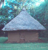
The Gwassi inhabitants have identified and reported the following species as extinct or are no longer available on Gwassi Hills; medicinal plants such as "Singuti" indigenous vegetable for example "Ndemra," " mito ," "omiyongra" and "omusibia." Indigenous trees for making canoes and boats "engoro" which is now commonly being imported from Uganda "Omwambutha" (Kong'o) and Omweria which were used for building houses.
Destruction of fish breeding grounds has also led to decreased fish population both in quantity and species. With fish now fetching at a poor or low price, the fisherman's income is reduced and the poverty along the lake region has escalated to a worrying point.
In Kaksingiri the community had a site along Sindo Beach , which was protected because it was a breeding ground for fish. But since the vegetation was destroyed by soil erosion, the population of fish has decreased both in quantity and species.
Efforts have been made to rescue the Gwassi Hills forest from further destruction and restoration of the forests for instance in 1950 the then Colonial Government in Kenya declared Gwassi Hills a protected forests area and put security guards of forest rangers to guard the area.
In 1993 a protection committee was formed and in 1984 and 1996 illegal settlers were evicted from Gwassi Hills. Danida, the Danish NGO had initiated a reforestation programme in Gwassi.
The local communities have also put up their interventions to protect the forests like establishing forest boundary and cultural control measures through taboo. Elders could curse those violating the norms and impose punishment in the forms of fines.
The Catholic and Maranatha Churches have since created awareness among their congregation on the importance of trees.
Mass eviction of illegal settlers and encroaches could not be effectively organized due to logistic problems. Instead, the forest department attempted piecemeal eviction. However this was not successful due to confrontations from hostile farmers who forced the forest personnel to retreat. The encroachers threatened the officials with legal suits and proceedings against the Forest Department for arson and destruction of property. These settlers are still dwelling in the areas affected in total defiance of the law.
The forest department has made an attempt to mark boundary through various ways for example, beacons have been tried with success. Debarking standing trees has marked the forest boundary. Due to shifting of the boundary by encroachers, boundary painting was recommended. This sketchy boundary line runs approximately along the 500 feet contour all over Gwassi Hills. The main limitation to putting a clear boundary has lacked paints. The painted features are far apart and in some cases they are faint: -
The resolution to conserve Gwassi Hills was first mooted in the early 1950 by the then African District Council of South Nyanza (ADC). This was followed by several meetings in 1960s, 1970s and 1983 where the same objective proposals were then formulated to rehabilitate, protect and manage the Gwassi Hills forest reserve environment. Particular attention was focused on the hilltops and areas on steep slopes that were greater than 30 percent below and covering about 500 hectares.
A number of institutions and Community Based Organizations (CBO's) have been engaged in activities aimed at uplifting the economic status of the Gwassi Hills local community while at the same time creating environmental awareness.
One such organization is the Gwassi Community Department Organization (GWACODO), which was established in 1992 with the support from MS-Kenya, a Danish International Organization following the Awareness Building Course (ABC).
GWACODO was empowered to address issues pertaining to health, water, trees, roads and also empowerment of women among others. GWACODO, according to the local people has made tremendous impact on the people in Gwassi Hills regions as amplified by its achievement. It is credited with the record setting up of a county based dispensary, protected springs at Kisaku and Kaminande areas, piped water project of Italian - Kenya Development Project at Tonga , Kasoin and Kimunde.
ENDS.
leooderaomolo@yahoo.com
ABOUT THE AUTHOR
Leo Odera Omolo is a veteran journalist operating in Western Kenya as a freelance scribe. He is also the author of children books and sugar cane as well as a dairy farmer in Migori District.
Joluo.com
Ka in gi mari moro ma di wandik ka to orni
Akelo nyar Kager,
jaluo@jaluo.com
Daher winjo dwondi in bende, iwinjo?
Inyalo oro twak kod weche manyien ne: Mig. Ajos wuod Atiga
WuonAbila@jaluo.com
GALAMORO : Riwruok mar JOLUO e Piny Ngima, orwaku uduto mondo ubed e kanyakla mar burani. Ornwa nyingi gi nondi kaka obedo. Riwruok e teko joka Nyanam.